


Voting District 5000076, Kings County, New York
About
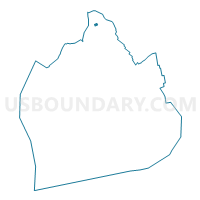
Outline

Summary
| Unique Area Identifier | 628736 |
| Name | Voting District 5000076 |
| County | Kings County |
| State | New York |
| Area (square miles) | 0.02 |
| Land Area (square miles) | 0.02 |
| Water Area (square miles) | 0.00 |
| % of Land Area | 100.00 |
| % of Water Area | 0.00 |
| Latitude of the Internal Point | 40.72460320 |
| Longtitude of the Internal Point | -73.95126270 |
Maps

Graphs
Select a template below for downloading or customizing gragh for Voting District 5000076, Kings County, New York


Neighbors
Neighoring Voting District (by Name) Neighboring Voting District on the Map
- Voting District 5000073, Kings County, NY
- Voting District 5000075, Kings County, NY
- Voting District 5000077, Kings County, NY
- Voting District 5000078, Kings County, NY
- Voting District 5000079, Kings County, NY
- Voting District 5000086, Kings County, NY
Top 10 Neighboring County Subdivision (by Population) Neighboring County Subdivision on the Map
Top 10 Neighboring Place (by Population) Neighboring Place on the Map
Top 10 Neighboring Unified School District (by Population) Neighboring Unified School District on the Map
Top 10 Neighboring State Legislative District Lower Chamber (by Population) Neighboring State Legislative District Lower Chamber on the Map
Top 10 Neighboring State Legislative District Upper Chamber (by Population) Neighboring State Legislative District Upper Chamber on the Map
Top 10 Neighboring 111th Congressional District (by Population) Neighboring 111th Congressional District on the Map
Top 10 Neighboring Census Tract (by Population) Neighboring Census Tract on the Map
- Census Tract 571, Kings County, NY (4,400)
- Census Tract 561, Kings County, NY (3,295)
- Census Tract 573, Kings County, NY (2,608)
- Census Tract 517, Kings County, NY (1,735)
- Census Tract 569, Kings County, NY (1,630)